
River Trails in the Headwaters of the Kentucky River
All trails lead to Beattyville, KY.
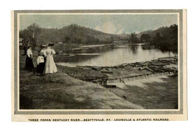
Tucked into the hills of eastern Kentucky, Beattyville holds a distinction that surprises a lot of people. it is the birthplace of the Kentucky River. This is the exact spot where the North Fork, Middle Fork, and South Fork come together, forming the official beginning of the Kentucky River’s 255-mile journey across the state. Before the river winds past cliffs, farms, cities, and eventually toward the Ohio River, it starts right here in Beattyville. Standing at the confluence in Beattyville, it becomes clear why this place matters. Three rivers meet. A major Kentucky waterway begins. A new chapter continues to unfold, one centered on recreation, conservation, and connection to the outdoors. Whether you come to fish, paddle, float, or simply watch the water come together, Beattyville offers something rare. A beginning you can stand inside of...or better yet, paddle around at. If you are planning a trip to eastern Kentucky, do not just cross the river. Start here.
A Recreational Treasure
Historically, the Kentucky River was a lifeline. Timber and coal were transported downstream by boat, supporting industries and communities throughout the region. The river powered commerce and connected Appalachian towns to the rest of the state. Today, the river still works, just in a different way. Check out this description on the local historical marker "Kentucky River Forms Here"! Now it supports outdoor recreation, tourism, and quality of life. Anglers, paddlers, and boaters come for quiet water, abundant wildlife, and scenery that remains largely untouched. This stretch of river offers authentic Kentucky experiences rooted in the land and its history.
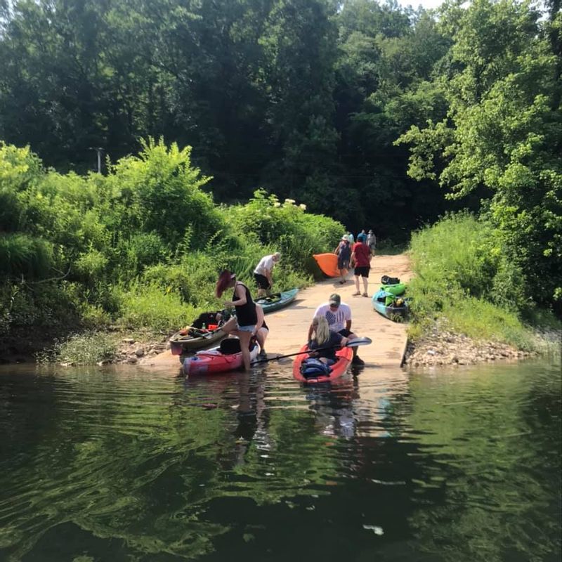
South Fork of the KY River Paddle Experience
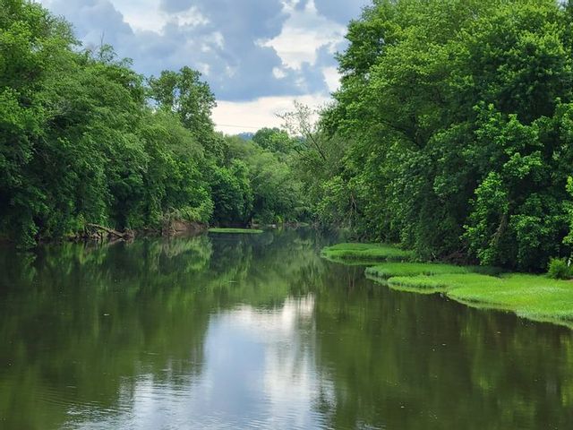
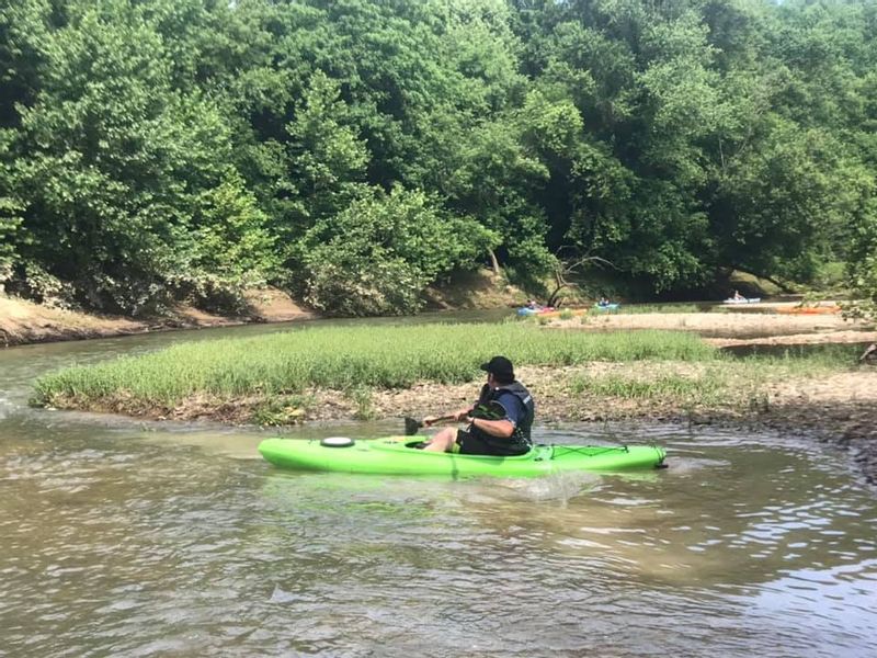
The South Fork of the Kentucky River has more movement and character than the other forks, with water levels that change by season and keep each trip feeling fresh. Some days offer an easy, relaxing float, while others bring a gentle current that adds a bit of excitement without being overwhelming. Wildlife sightings are common along this stretch, and it remains a favorite among local paddlers who know the river well. This fork is well suited for those who enjoy a little energy in their paddle and like paying attention to how the river moves and responds as they travel downstream.
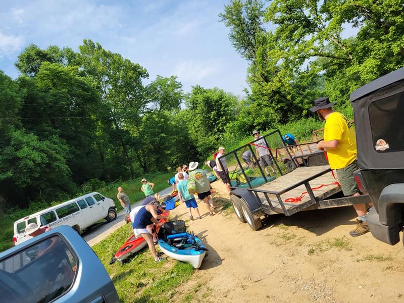
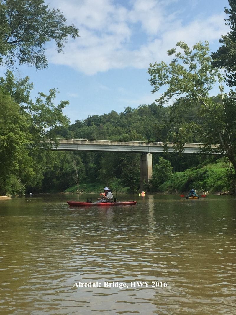
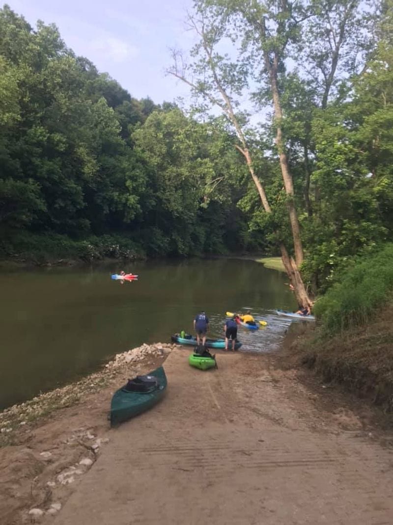
In the summer months, Beattyville Lee County Tourism, Beattyville Main Street, and community partners host a memorable 25-mile overnight kayak camping trip on this stretch of the river. The experience carries paddlers from the Clay and Owsley County line at Wolfe Creek Boat Ramp all the way into Beattyville, following the river as it flows toward its birthplace. Participants are taken care of from start to finish, with shuttle service, breakfast, and a catered dinner included. Evenings are spent riverside with a campfire and storytelling, creating a shared experience that blends adventure, history, and the simple joy of being on the water. Launching locations: Wolfe Creek Boat Ramp - Mile 1 Kay Wood Low Water Bridge - Mile 6 Fish Creek Boat Ramp - Mile 14 Beattyville Boat Ramp - Mile 25
In the summer months, Beattyville Lee County Tourism, Beattyville Main Street, and community partners host a memorable 25-mile overnight kayak camping trip on this stretch of the river. The experience carries paddlers from the Clay and Owsley County line at Wolfe Creek Boat Ramp all the way into Beattyville, following the river as it flows toward its birthplace. Participants are taken care of from start to finish, with shuttle service, breakfast, and a catered dinner included. Evenings are spent riverside with a campfire and storytelling, creating a shared experience that blends adventure, history, and the simple joy of being on the water. Launching locations: Wolfe Creek Boat Ramp - Mile 1 Kay Wood Low Water Bridge - Mile 6 Fish Creek Boat Ramp - Mile 14 Beattyville Boat Ramp - Mile 25
North Fork of the KY River Paddle Experience
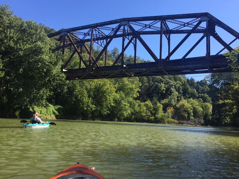
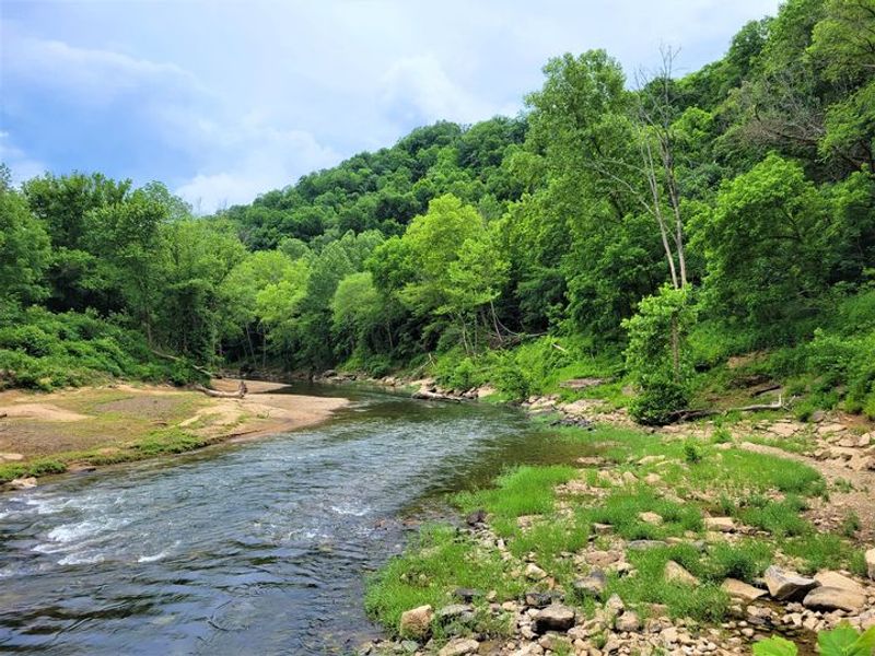
The North Fork is known for scenic cliffs, quiet bends, and strong fishing opportunities. This stretch feels wild and personal, offering space to disconnect and slow down. What visitors enjoy most are: - Calm stretches ideal for beginner and intermediate paddlers - Rock walls and forested banks - Smallmouth bass and other sport fish This fork is ideal for those seeking solitude without giving up accessibility. Check out this 3 mile paddle on North Fork of the Kentucky River. Starting at the Sharp Rock Boat Ramp, travel upstream and just around the bend to see the Maloney Railroad Bridge and Sharp Rock, the namesake of the boat ramp. Then paddle downstream to the Beattyville Boat Ramp.
For Advanced Adventure Paddling Experiences
For experienced paddlers looking for a true backcountry adventure, check out this 33-mile paddle from Vancleve to Beattyville. This route is recommended for advanced paddlers only and is best tackled as a two-night river camping trip, with boats loaded down with camping gear and supplies. Along the way, paddlers are rewarded with towering cliff faces, massive river boulders, and long stretches of clear water. Notable landmarks include Blasted Rock, T Table, Turtle Head Rock, Devil’s Backbone, and other striking geological features that rise directly from the river corridor. Rock shoals appear around nearly every bend, creating a sense of movement and challenge while also offering frequent opportunities to pull over, explore, stretch your legs, or set up camp along the riverbank. It is a demanding trip, but one that delivers some of the most dramatic and unforgettable scenery on the Kentucky River system. Check out the video from May 2025!The North Fork of the Kentucky is on its way to becoming a Blue Water Trail. Stretching from Beattyville all the way to Whitesburg. KRADD is working with the National Park Service and Communities along the way to map and plan the trail.
33 Mile Trip Vancleve to Beattyville
Click an image below to display the larger version.
Beattyville/Lee County Tourism
500 HWY 11 North
Beattyville, KY 41311
+1 (606) 464-5038
www.visitleecountyky.com
Mon
9:30am–5:30pm
Tue
9:30am–5:30pm
Wed
9:30am–5:30pm
Thu
9:30am–5:30pm
Fri
9:30am–5:30pm